Projects
Real-world terrain modeling, site analysis, and early-stage design support.
Edgartown Coastal Mapping & Revetment As-Built

Stone Revetment As-Built
Scope:
Drone-based orthomosaic and as-built survey of a coastal stone revetment.
Deliverables:
• High-resolution orthomosaic
• Elevation and contour data
• Revetment alignment and verification
Outcome:
Enabled accurate comparison between design intent and constructed shoreline conditions, supporting engineering review and compliance.


Edgartown, MA | Orthomosaic, Contours & As-Built Mapping
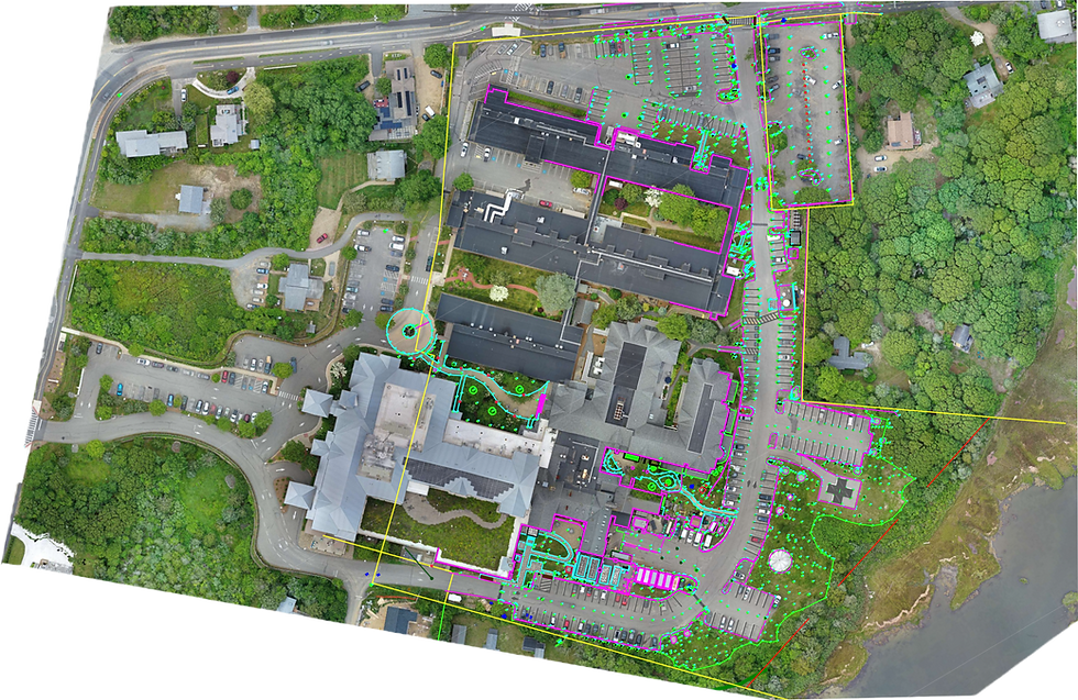
Site Documentation & Survey Verification — Martha’s Vineyard Hospital

Survey Verification & Accuracy Analysis
Scope:
Drone-based orthomosaic to support detailed site documentation and verification of existing survey data.
Key Insight:
Orthomosaic alignment closely matched field survey data, validating positional accuracy while revealing missing site elements.
What It Enabled:
• Visual verification of survey linework against real-world conditions
• Identification of missed features (bollards, site elements, etc.)
• Rapid back-checking without additional field mobilization
Outcome:
Provided a high-confidence visual base map that enhanced survey completeness and improved downstream design accuracy.


Oak Bluffs, MA | Orthomosaic | Survey Verification
Tennessee Experiential Community – Terrain & Feasibility Modeling
Primm Springs, TN | LiDAR Terrain Modeling | Constraint & Feasibility Analysis


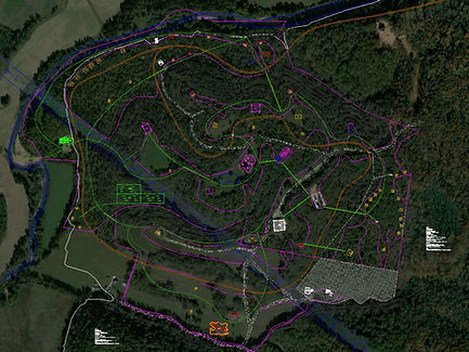

Terrain Modeling & Feasibility Analysis
Scope:
Developed a terrain-based feasibility model using USGS LiDAR data to evaluate development potential across a large, topographically complex site.
Key Insight:
Slope analysis revealed significant terrain constraints (>25% grade) across large portions of the property, requiring strategic identification of buildable zones.
What It Enabled:
• Clear identification of viable development areas based on slope and terrain conditions
• Integration of FEMA floodplain data to assess environmental constraints
• Early-stage planning support for roads, access, and site layout
• Rapid visualization of complex terrain for client decision-making
Outcome:
Delivered a high-confidence terrain and feasibility model that transformed raw elevation data into actionable development insight, supporting early-stage planning of a large-scale experiential community.
