top of page

Mapping & Remote Sensing
-
High-resolution orthomosaic imagery
-
2D & 3D topographic mapping
-
Lidar services for detailed as-builts and surface modeling
-
Digital elevation models (DEM/DTM)
-
Volumetric analysis for stockpiles and earthworks
Orthosaic Imagery
2D Mapping
3D Mapping
Lidar Mapping
Digital Elevation/Terrain Models
Volumetric Surveys
Aerial Monitoring & Inspection
-
Utility Infrastructure – Power lines, pipelines, and substations
-
Roof & Building Inspections – Structural integrity assessments
-
Solar Farms & Arrays – Panel performance monitoring and defect detection
-
Environmental & Coastal Monitoring – Erosion modeling, shoreline changes, and land-use analysis
-
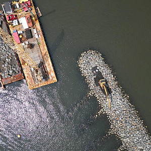
Coastal Engineering Support – High-resolution data for breakwater design, dune restoration, and flood risk assessment
-
Construction Progress Tracking – Regular site updates and compliance verification
Infrastructure Monitoring
Building Inspections
Solar Inspections
Erosion Monitoring
Coastal Engineering Minitoring
Construction Phase Monitoring
With advanced technology, expertise in aerial data collection, and a commitment to precision, Horizons Mapping provides the data and insights you need to move forward with confidence.
📍 Serving Nevada and beyond
Contact us today to discuss your project needs!
bottom of page


